| Vendee Information Vendee History Accommodation, Photos, Reviews, Maps, |
River Vie
Sud
Vendee.. Haut
Bocage.. Coastal
Region.. Marais
Poitevin.. Marais
Breton.. Bas Bocage.. Plaine.. Marais
Olonne..
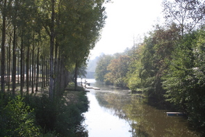
The River Vie is
the shortest of all the major rivers in the vendée, being 62.2 kilometers
long, but nevertheless it has had great importance in the past and continues to
play a vital important role both commercially and as a natural resource.
The
River Vie rises in the heart of the Bas Bocage
at Belleville-sur-Vie, 10 kilometres north of La Roche-sur-Yon and flows west
passing north of le Poire-sur-Vie, through La Chapelle-Palluau before entering
the Vendée's largest lake just a few kilometers east of Mache. The lake was
formed by damming the river Vie at Apremont and
this vast stretch of water is both recreational with fishing, walking, boating
and swimming from the beach at Apremont and as an important habitat for both
flora and fauna. The lake also acts as a fresh water reservoir supplying
drinking water to a large part of North West Vendée.
From Apremont the River
Vie continues its westward flow as it gently meanders its way across the bocage
north of St.Maixent-sur-Vie before being joined by the River Ligneron (26.9kms)
south of Notre Dame-de-Riz. A few kilometres further on it enters and drains the
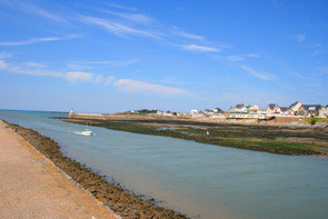
salt marshes of St.Hilair-de-Riez, then flows under the bridge at St.Gilles-Croix-de-Vie to be joined in the harbour by the river
Jaunay and on out into the Atlantic Ocean.
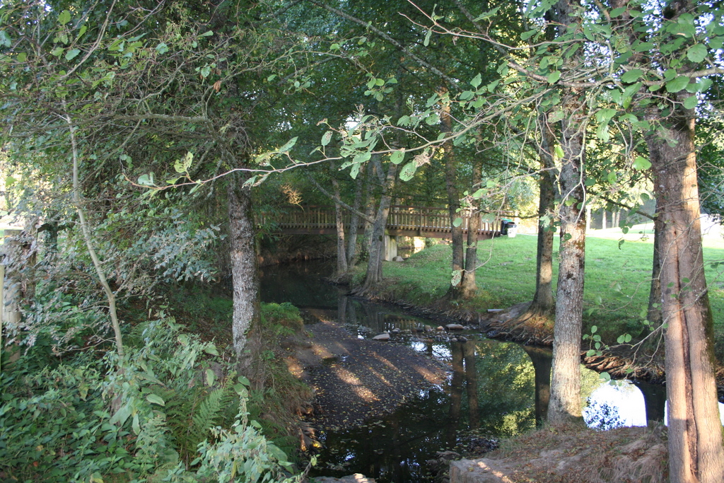
Le Jaunay. This is the largest of the
tributaries of the River Vie and is almost as long at 45 kilometres. Rising at
Vanansault north west of La Roche-sur-yon at an altitude of 50 meters, it
flowing through Beaulieu-sous-la-Roche, Matinet and La Chapelle-Hermier before
entering the Lac de Jaunay 3 kilometers south of Coex. The Lac de
Jaunay was formed in a steep sided, wooded valley by a 200m barrage at La
Savariere. The lake is used as a reservoir for drinking water and contains 3.7
million cubic meters of water, is 8 kilometres long and covers 114 hectares. It
is also a beautiful recreational area especially for walking and fishing as well
as a natural habitat. Fishing is possible all year round except for Pike and
perch which is closed from the end of January to mid May.
After leaving the
lake the Jaunay continues westward to point near Givrand where it is only a few
hundred meters from the sea, it then turns north flowing parallel to the coast
to join the River Vie in St.Gilles-Croix-de-Vie.
Photos of
the River Vie
Return to find more Attractions of the
Vendée
In
accordance with the law "and Freedoms" of January 6, 1978, you have the right to
access and rectify information concerning you. If you wish to exercise this
right, please contact
us.
© Copyright Vendee-Guide.co.uk 2009-11
© Copyright Vendee-Guide.co.uk 2009-11
Loading