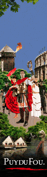

Tourist Information, Vendee History, Accommodation, Photos, Reviews, Maps,

Custom Search
Web |


|
| contact us | ||
| Advertise |
|
| month by month guide | ||
| Entertainment |
| January | ||
| February | ||
| March | ||
| April | ||
| May | ||
| June | ||
| July | ||
| August | ||
| September | ||
| October | ||
| November | ||
| December |
| Car Boot Sale | ||
| Discos |
|
| Getting About | ||
| Public Holidays, | ||
| Getting to the Vendee | ||
| Bike Hire | ||
| Photos | ||
| Weather | ||
| Vendee Wars | ||
| Videos | ||
| Maps & Books | ||
| Vendee Wines | ||
| Vendee Information |
|
| Vendee Restaurants | ||
| Coastal Region | ||
| Haut Bocage | ||
| Bas Bocage | ||
| Plaine | ||
| Sud Vendee | ||
| Marais Poitevin | ||
| Marais Breton | ||
| Marais Olonne |
|
| All Activities | ||
| fishing | ||
| sailing | ||
| golf | ||
| Walking | ||
| Cycling | ||
| Surfing | ||
| Karting | ||
| Swimming | ||
| Canoeing | ||
| Paintball | ||
| Horse Riding | ||
| Adventure Parks | ||
| Arts & Crafts |
|
| All Attractions | ||
| Theme Parks | ||
| Towns and Villages | ||
| Chateaux and Churches | ||
| beaches of the vendee | ||
| Adventure Parks | ||
| Amusement Parks | ||
| Water Parks | ||
| Childrens Attractions | ||
| Markets | ||
| Zoos & Gardens | ||
| Museums | ||
| Rivers of the Vendee | ||
| Vendee Islands | ||
| Vendee Wars Sites | ||
| Mills of the Vendee |
| inland beaches |
|
| Gites | ||
| Hotels | ||
| Camping | ||
| Bed & Breakfast |
| Gites with Pools | ||
| Gites Complex | ||
| All Gites |
| Camping Coastal Region | ||
| Camping Haut Bocage | ||
| Camping Marais Poitevin | ||
| Camping Sud Vendee |
|
| Coastal Region | ||
| Bas Bocage | ||
| Haut Bocage | ||
| Plaine | ||
| Sud Vendee | ||
| Marais Poitevin | ||
| Marais Breton | ||
| Marais Olonne | ||
| Mervent Forest |
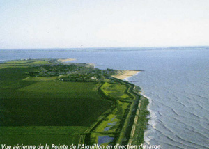
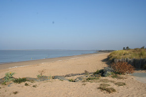
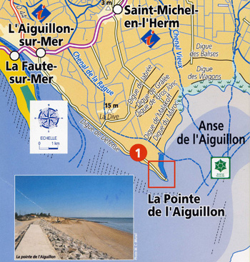
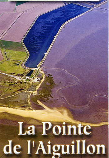
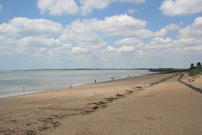
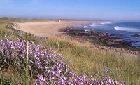
La Pointe de l'Aiguillon
L'Aiguillon (
french for needle or spit) owes its name to the shape of this narrow
band of sand which was formed between the 5th and 7th Centuries and
stands upon a submerged bedrock.
The sandbanks are accumulated by tidal currents and wind action and have resulted in a string of sand dunes that stretch in an 11km loop.
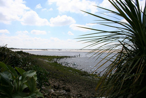
The once Gulf of Picton has today been reduced to the 5,000 ha of mudflats known as the "anse de l'Aiguillon", it is a bird watchers paradise as twice a year the migratory birds stop off here in there thousands and today it is a national Nature Reserve.
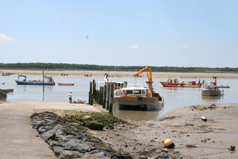
In the estuary of the River lay and in the Anse de l'Aiguillon there thrives an industry based on Mussels with over twenty percent of the French production of mussels are produced here, there are also oyster farms on the land side of the dyke,for over 5 kilometers the river bank was reinforced by a stone and concrete dyke built by the Dutch, this stop the flooding of the low lying land.
Return to find more Attractions of the Vendee
The sandbanks are accumulated by tidal currents and wind action and have resulted in a string of sand dunes that stretch in an 11km loop.
The once Gulf of Picton has today been reduced to the 5,000 ha of mudflats known as the "anse de l'Aiguillon", it is a bird watchers paradise as twice a year the migratory birds stop off here in there thousands and today it is a national Nature Reserve.
In the estuary of the River lay and in the Anse de l'Aiguillon there thrives an industry based on Mussels with over twenty percent of the French production of mussels are produced here, there are also oyster farms on the land side of the dyke,for over 5 kilometers the river bank was reinforced by a stone and concrete dyke built by the Dutch, this stop the flooding of the low lying land.
Return to find more Attractions of the Vendee
In
accordance with the law "and Freedoms" of January 6, 1978, you have the
right to access and rectify information concerning you. If you wish to
exercise this right, please contact us.
© Copyright Vendee-Guide.co.uk 2009-12 This Website is built with Bluevoda from Vodahost
© Copyright Vendee-Guide.co.uk 2009-12 This Website is built with Bluevoda from Vodahost